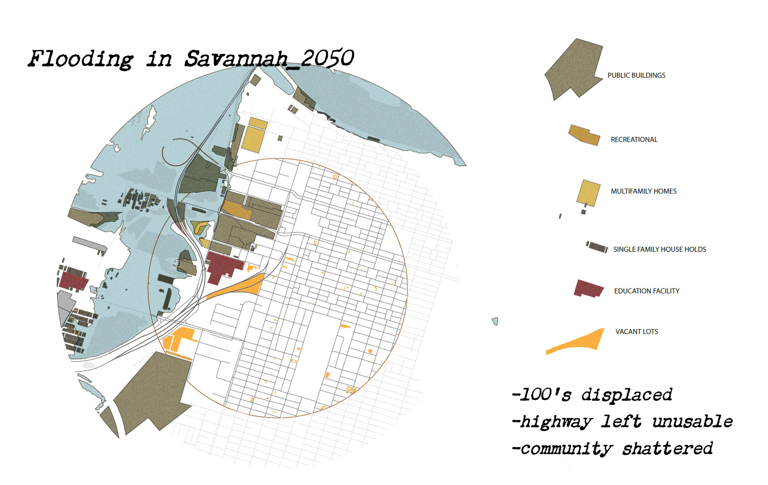
Created with ESRI ArcMaps Pro, Illustrator, and Photoshop.
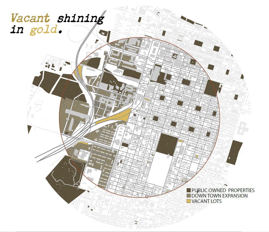
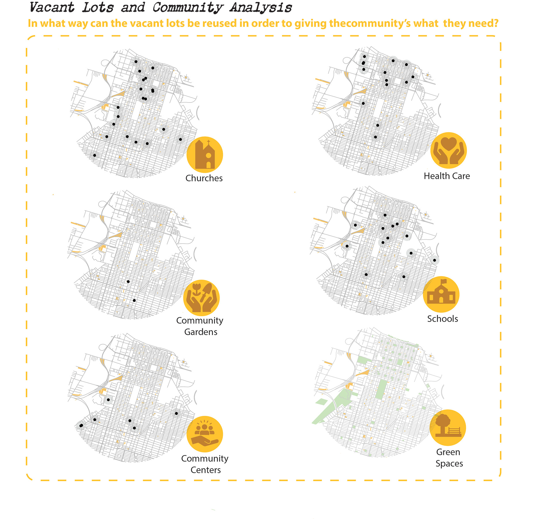
Map of Vacant Lots created with ArcMaps Pro, Illustrator, and Photoshop
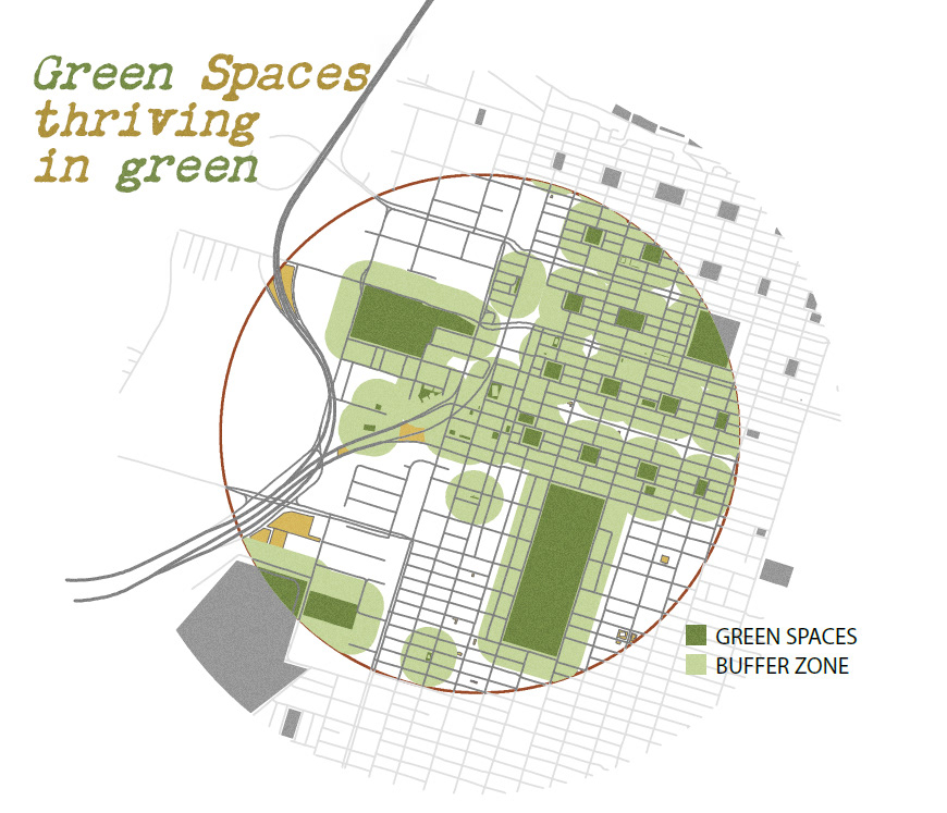
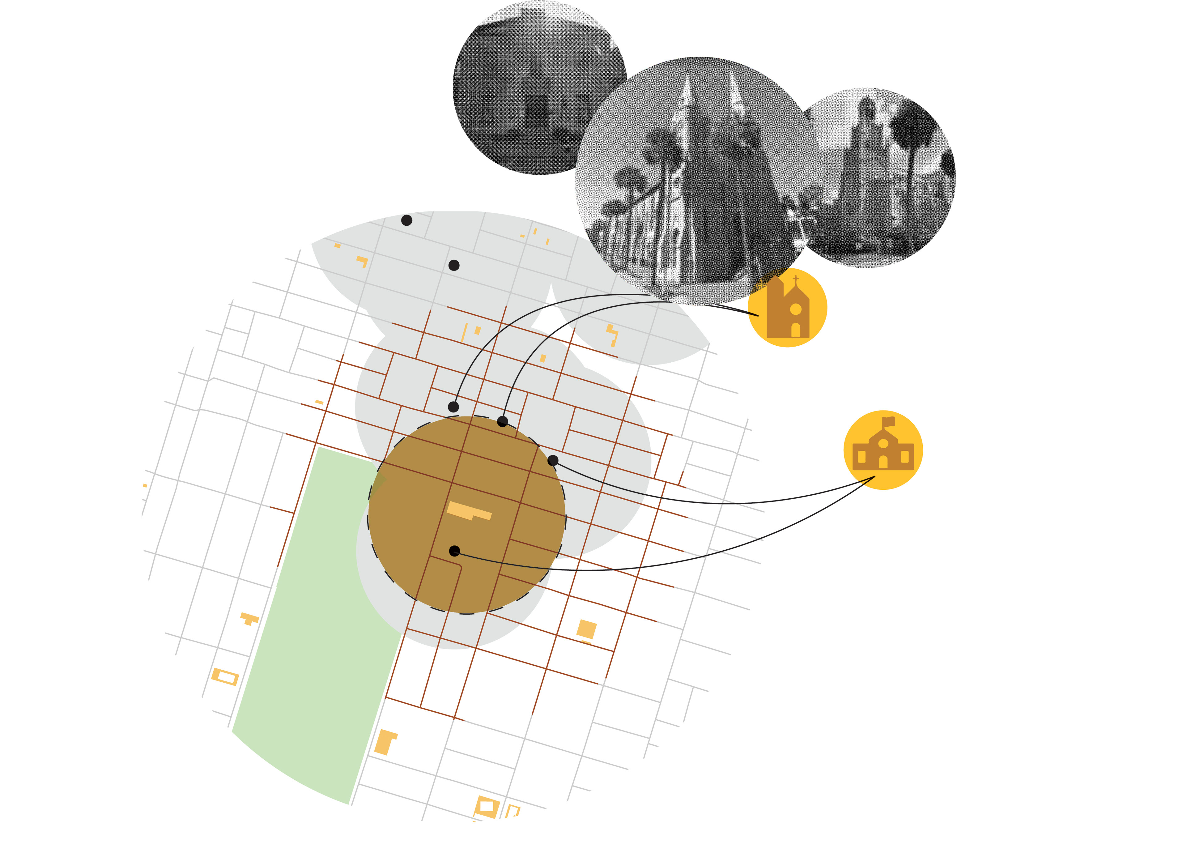
Overlay of green spaces and vacant lots created with ArcMaps Pro, Illustrator, and Photoshop
Created with ESRI ArcMaps Pro, Illustrator, and Photoshop.
Created with ESRI ArcMaps Pro, Illustrator, and Photoshop.

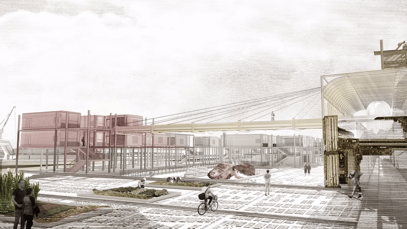
Created with SketchUp, Illustrator, Photoshop, After Effects
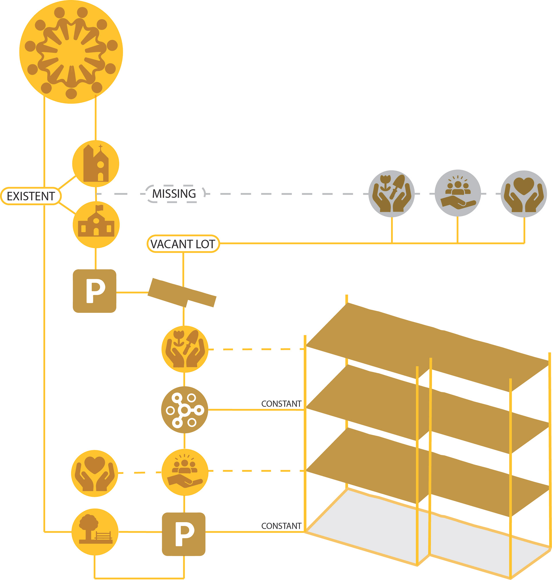
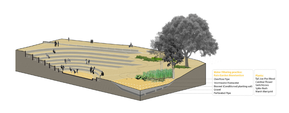
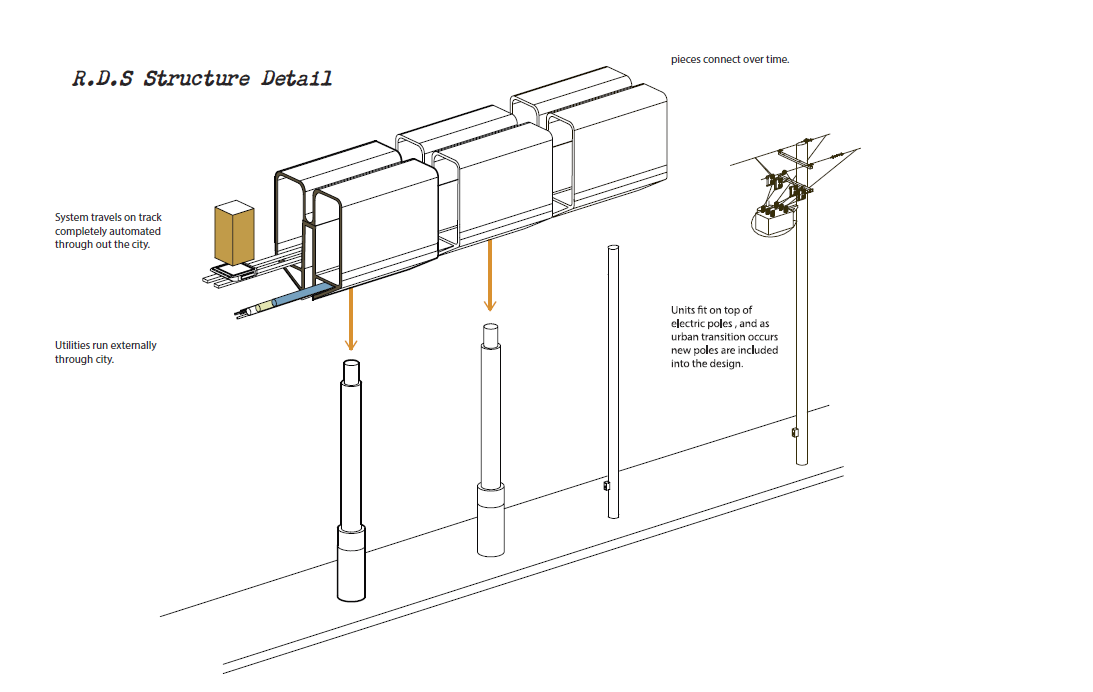
Created with Photoshop, and Illustrator

Created with ESRI ArcMaps Pro, Illustrator, and Photoshop.

Created with ESRI ArcMaps Pro, Illustrator, and Photoshop.

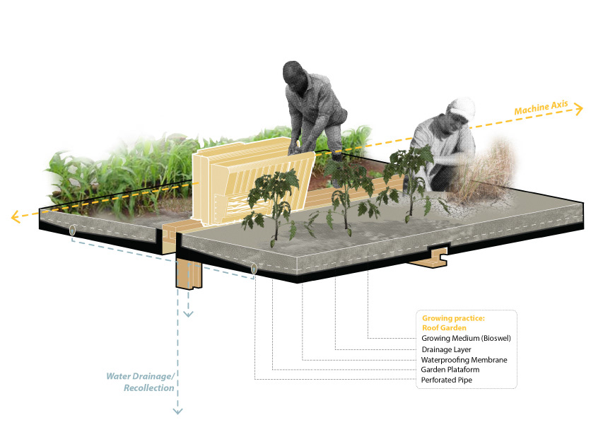
Created with Illustrator, and Photoshop.
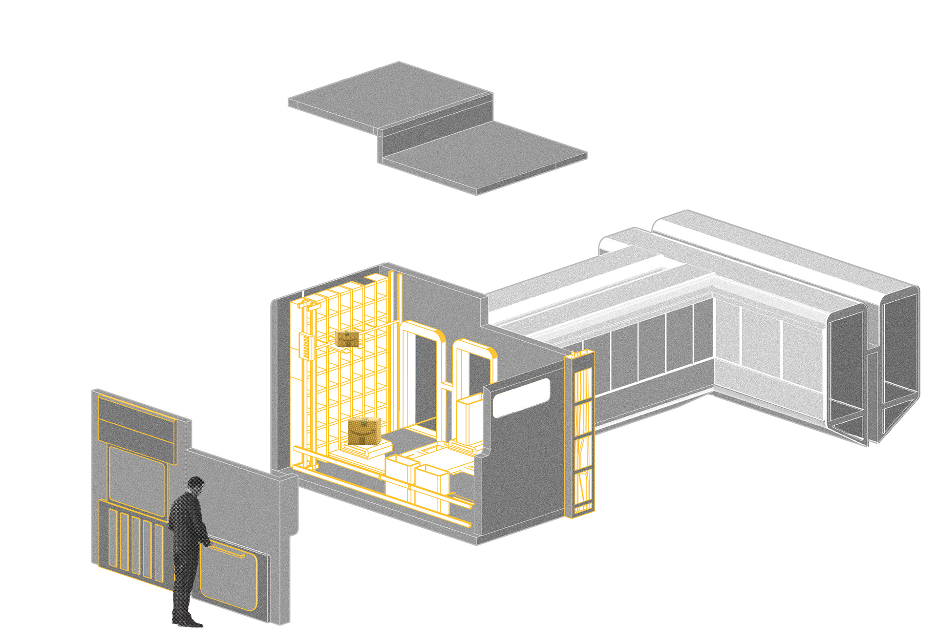
Created with SketchUp, Revit, VRay Rendering Software, Photoshop, and After Effects.
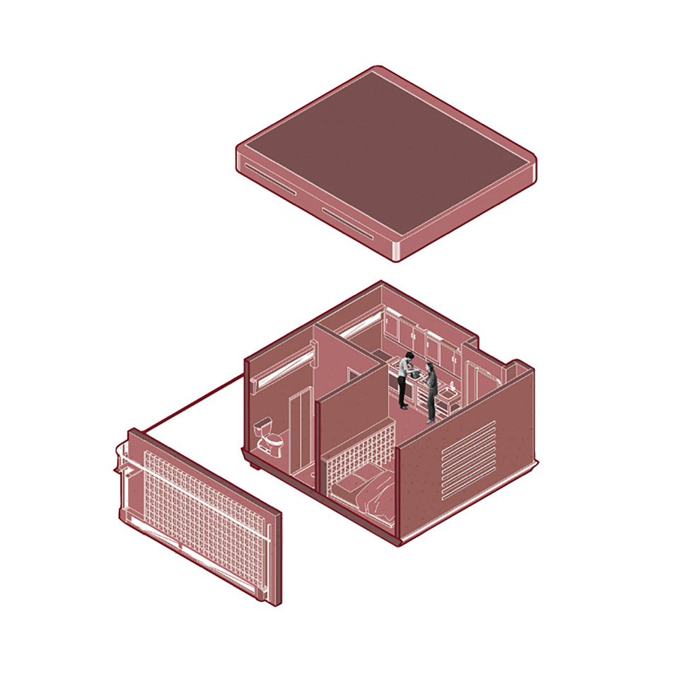
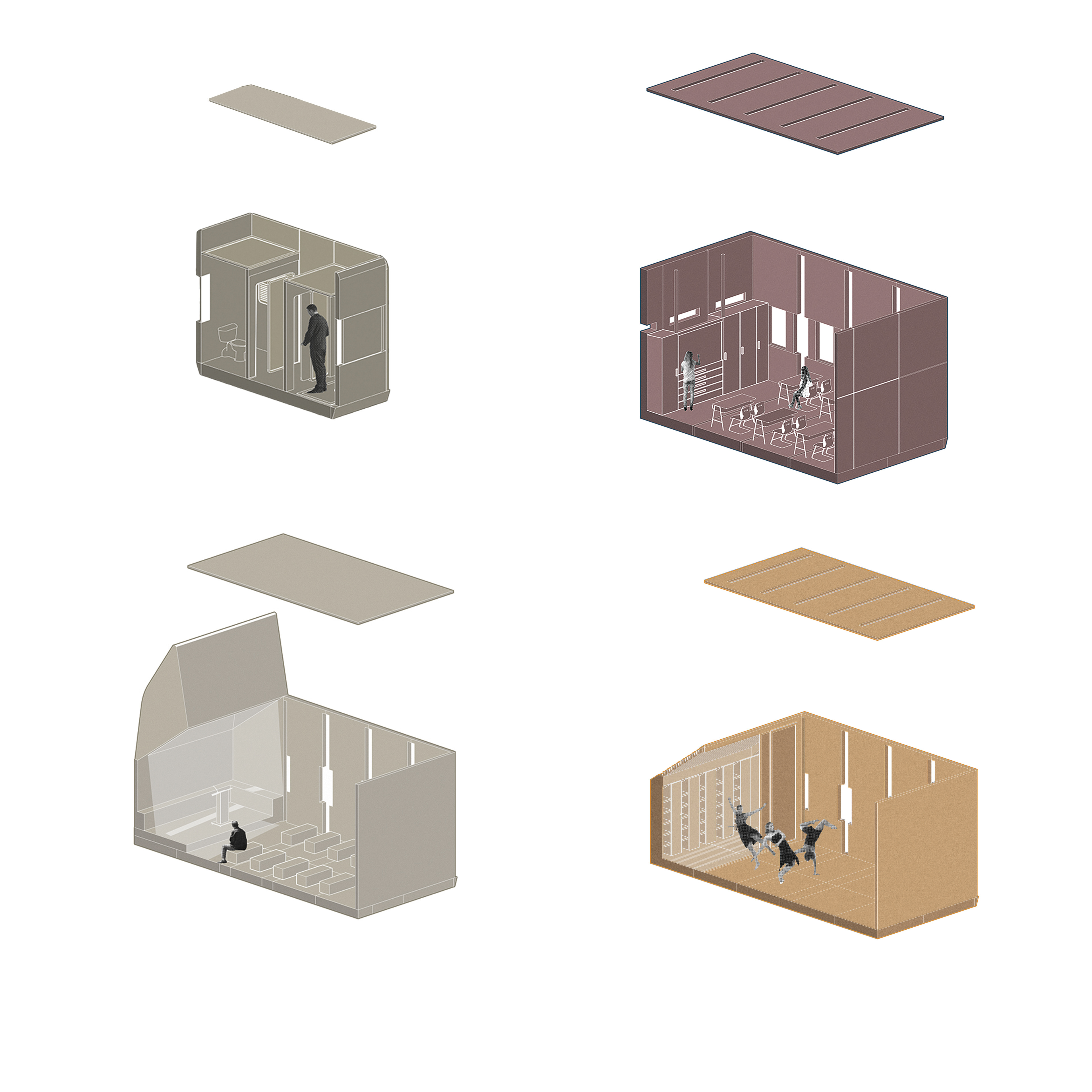
Single family module, Created with SketchUp, Illustrator, and Photoshop
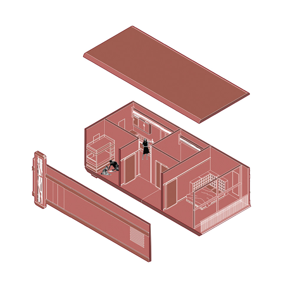
Multi-family module, Created with SketchUp, Illustrator, and Photoshop
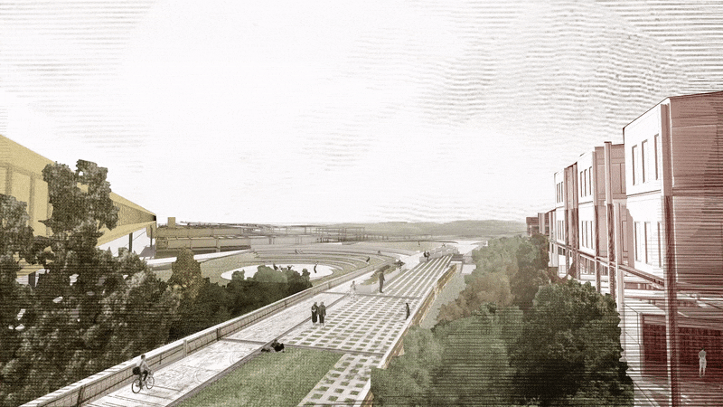
Created with SketchUp, Revit, VRay Rendering Software, Photoshop, and After Effects.
Created with Revit, Illustrator and Photoshop
Created with SketchUp, Revit, VRay Rendering Software, Photoshop, and After Effects.
Created with SketchUp, Revit, VRay Rendering Software, Photoshop, and Illustrator
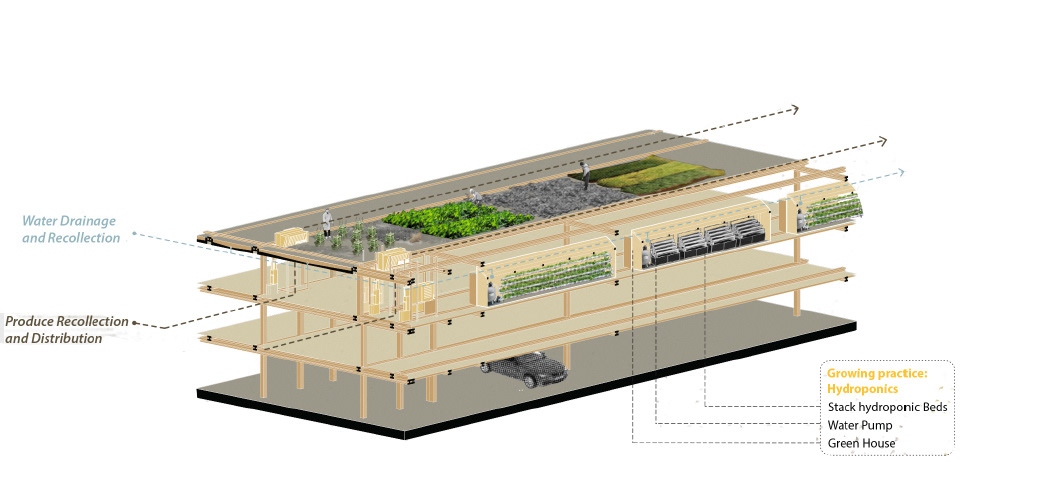
Created with SketchUp, Revit, Photoshop, and Illustrator
Created with SketchUp, Revit, Photoshop, and Illustrator
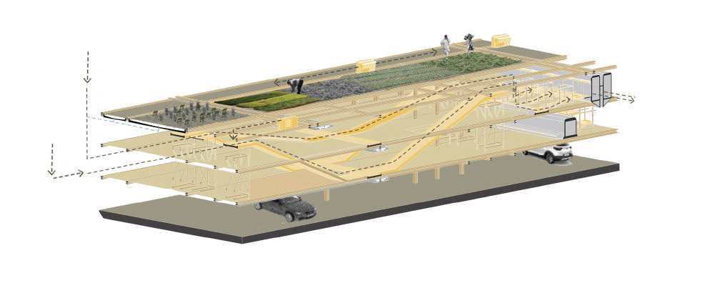
Created with SketchUp, Revit, VRay Rendering Software, Photoshop, and After Effects.

Market Module. Created with SketchUp, Illustrator, and Photoshop
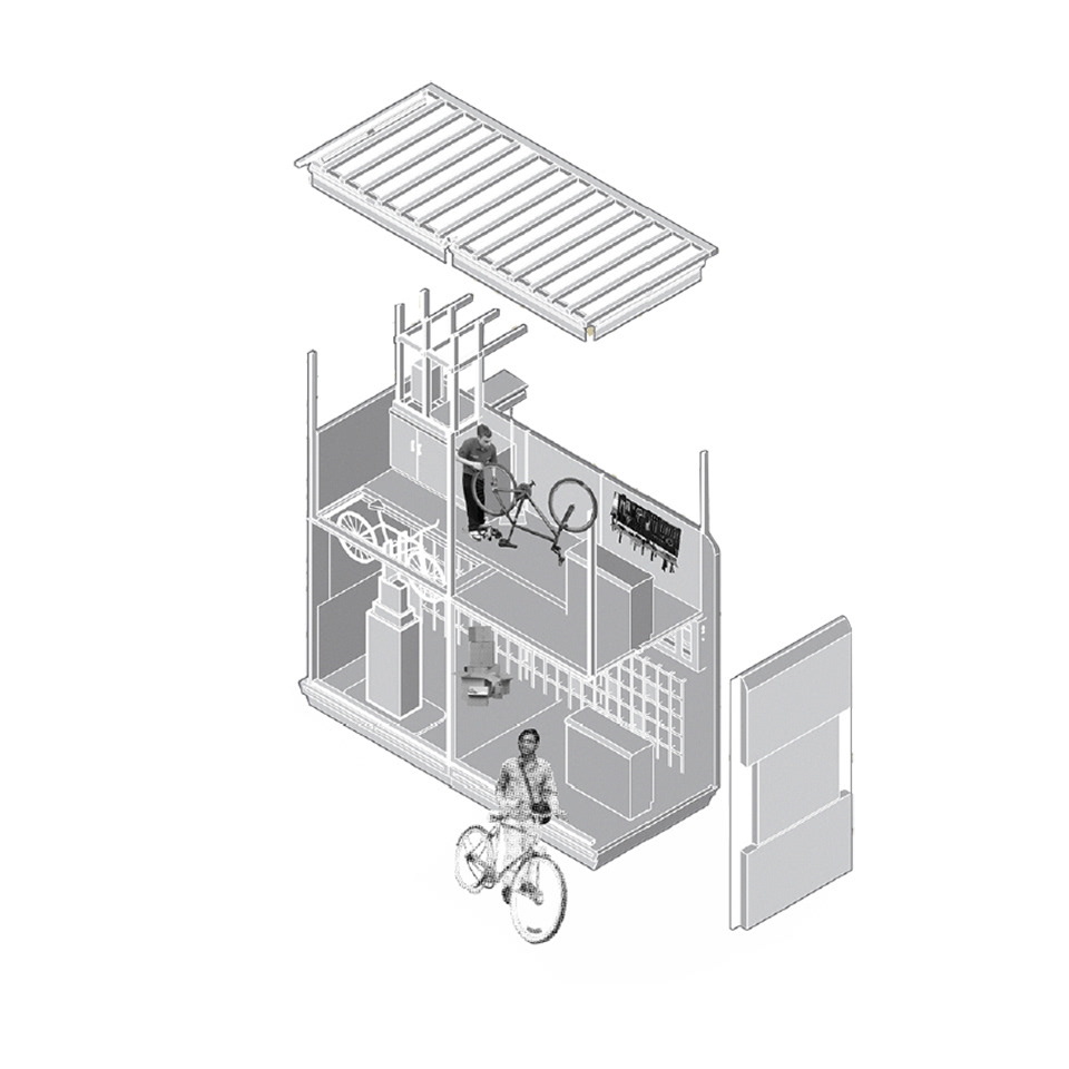
Bike Shop Module. Created with SketchUp, Illustrator, and Photoshop
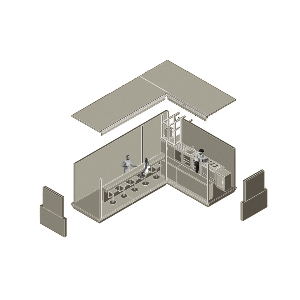
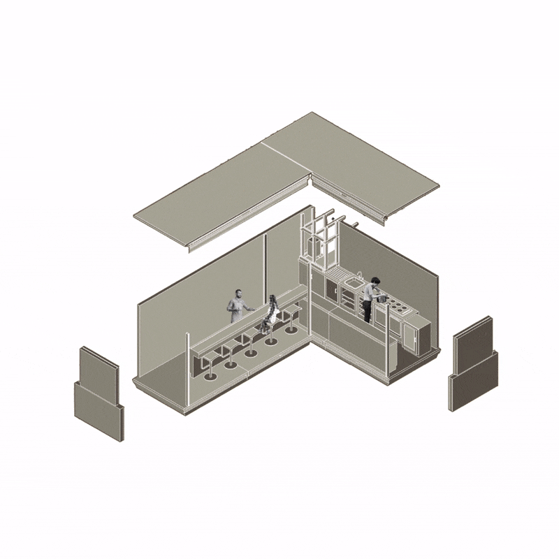
Cafe Module. Created with SketchUp, Illustrator, and Photoshop
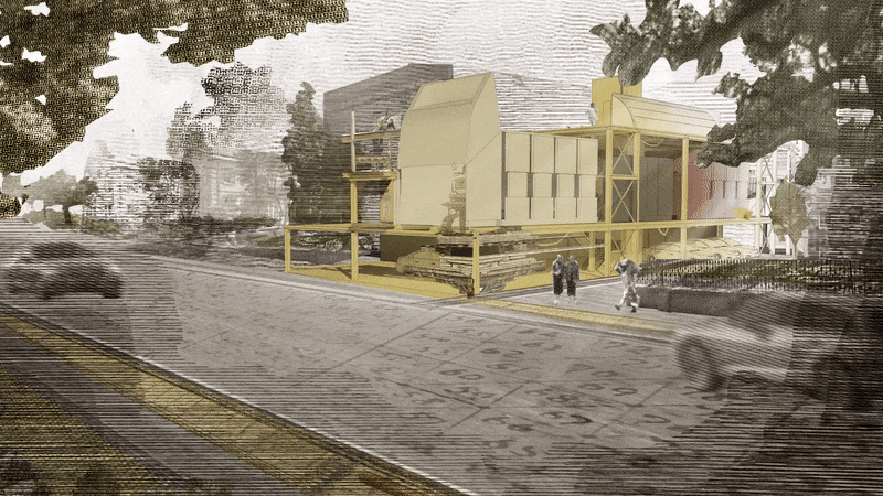
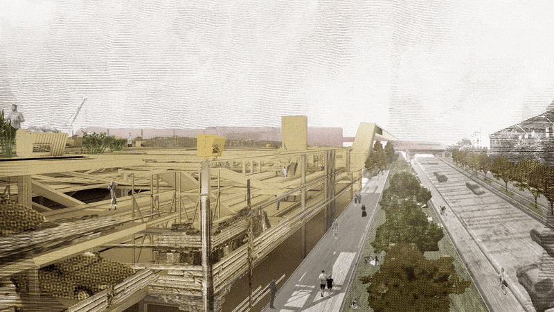
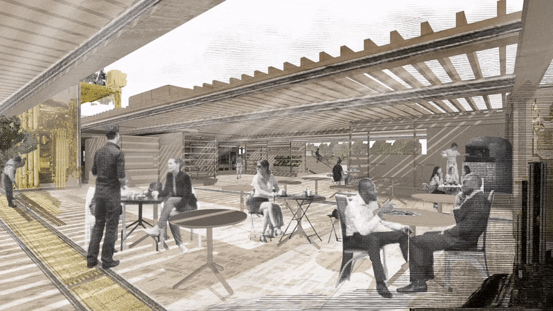
Created with SketchUp, Revit, VRay Rendering Software, Photoshop, and After Effects.
Created with SketchUp, Photoshop, and Illustrator.
Created with SketchUp, Photoshop, and Illustrator.
Created with SketchUp and Illustrator.
Created with ESRI ArcMaps Pro, SketchUp, Revit, VRay Rendering Software, Photoshop, Illustrator, and After Effects.